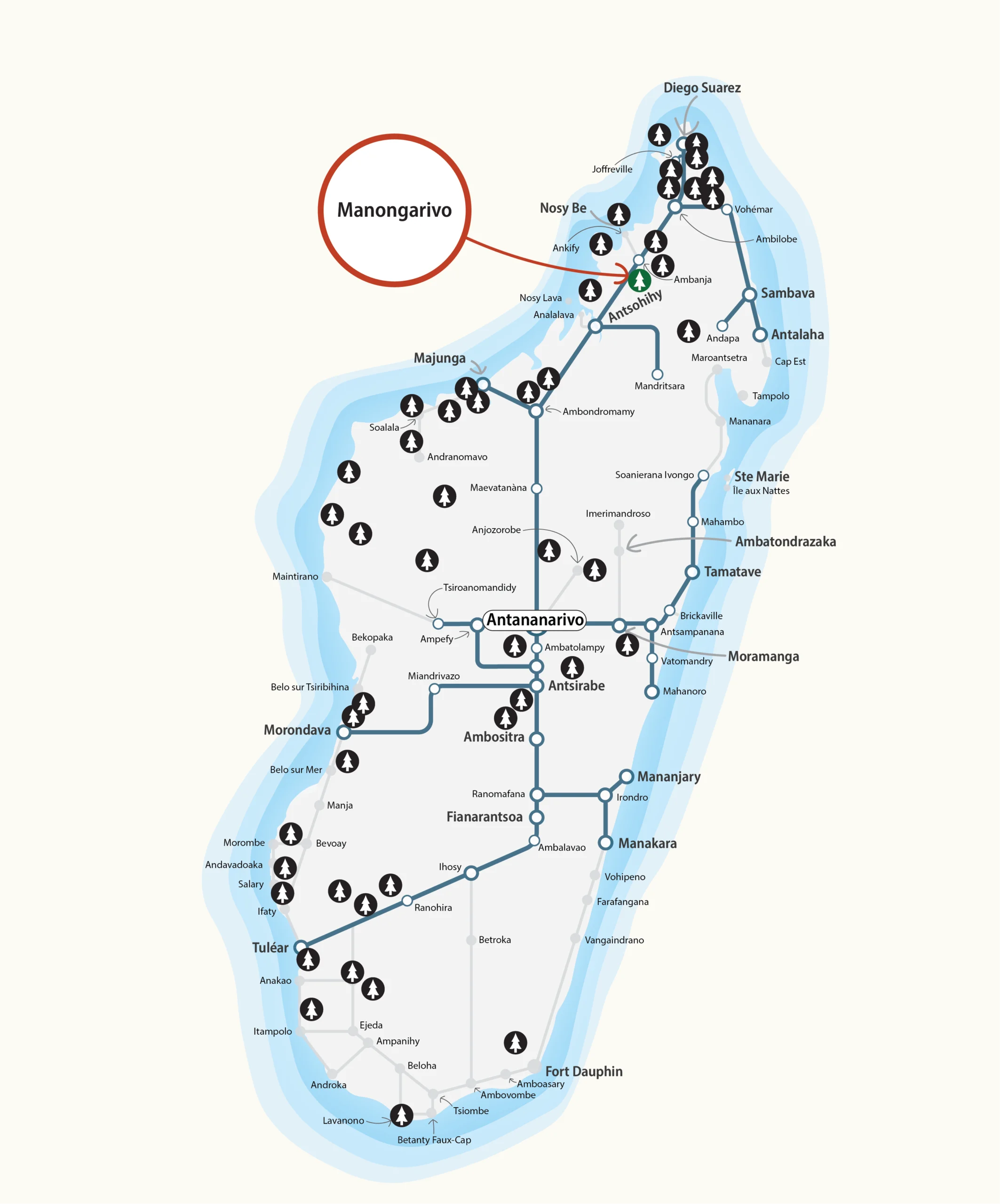
Special Reserve · DIANA Region · Protected Areas of Madagascar · North
Manongarivo
Special Reserve
A steep and rugged massif rising above 1,000 m near Ambanja, one of northern Madagascar's most botanically exceptional reserves, sheltering 40 plant species found nowhere else on Earth alongside an extraordinarily rich assemblage of lemurs, amphibians, and birds.
About the protected area
A rugged massif above Ambanja, botanically exceptional
The Special Reserve of Manongarivo is one of the Protected Areas of Madagascar in the Northern Region. Established in 1956 and subject to a boundary revision in 2015, it covers 51,568 ha and is managed by Madagascar National Parks.
The Manongarivo massif is deeply dissected, with steep slopes whose interior ridgelines rise above 1,000 m. The highest point, Antsatrotro, reaches 1,876 m. The reserve lies within the DIANA region, some 35 km from the town of Ambanja.
Visitors are strongly advised to contact the manager's office before travelling to the site. Guides are required before entering the Manongarivo massif.
The manager maintains a principal office in Ambanja, with two sector offices located at Beraty and Manongarivo. The only visitor accommodation in the area is a village guesthouse at Antanambao-Ambahatra; arrangements for visits and overnight stays should be made directly with the manager.
Infrastructure and Access
Northern Madagascar, several entry points
The Special Reserve of Manongarivo lies within the DIANA region in northern Madagascar, approximately 35 km from Ambanja. The massif's rugged terrain demands careful route planning regardless of the approach taken.
The reserve is accessible from the west, near Ankaramihely, 30 km north of Maromandia. From the south-east, a track leads to Beraty over a distance of around 50 km. From the west, the reserve can also be reached via the RN4-12 between Ambanja and Bemaneviky, crossing the Sambirano river at Antsahamala and Antanambao. Guides are mandatory before entering the massif, and visitors are strongly recommended to seek information before setting out.
Fauna and Flora
Forest-clad slopes, 40 plant species found nowhere else
The climate is characterised by the sub-humid conditions typical of the northern part of Madagascar. The rainy season runs from November to April. The cool season extends from June to August with minimum temperatures of 7.5 °C, while the hottest period, December to February, sees peaks of up to 29.2 °C.
Manongarivo's vegetation is predominantly forested. At the foot of the massif, dense humid evergreen lowland forest remains intact, with a sparse understorey rich in ferns, lianas, and epiphytes. With increasing altitude, this gives way to dense humid evergreen mid-altitude forest.
40 plant species are known only from Manongarivo, notably among the ferns.
Culture and Socio-economic Practices
Sakalava and Tsimihety lands, sacred sites under pressure
The population surrounding the reserve is predominantly Sakalava and Tsimihety. The protected area contains several sacred sites of significance to local communities.
The reserve faces multiple converging pressures: deforestation, agriculture practised in forest undergrowth, hunting, extraction of precious hardwoods, and fire, notably fires associated with the cultivation of Cannabis sativa.
Identified threats
Location
North of Madagascar, DIANA Region
Manongarivo Special Reserve lies in the north of Madagascar within the DIANA region, some 35 km from Ambanja. The manager's principal office is based in Ambanja, with sector offices at Beraty and Manongarivo. Entry from the west near Ankaramihely, from the south-east via a track to Beraty, or from the west via the RN4-12 with a river crossing of the Sambirano at Antsahamala and Antanambao.